Hurricane Isaias: Hurricane Warning for part of the Florida Panhandle. Is your policy ready?
Hurricane Isaias is a strengthening Category 2 hurricane (105 mph) that NHC says could become a major hurricane, per NHC Public Advisory 10. Hurricane Isaias has maximum sustained winds of 105 mph, per NHC Public Advisory 10 (10 PM CDT / 11 PM ET Thursday). Winds are up from 100 mph in Advisory 9. A Hurricane Warning remains from Ocean Springs, MS to the Bay/Gulf County line, FL, and a Tropical Storm Warning from east of the Bay/Gulf County line to the Aucilla River, FL. The Storm Surge Warning still runs to the Suwannee River; a Storm Surge Watch remains from the Suwannee River to Yankeetown, FL. No watch/warning changes in Advisory 10. NHC says Isaias could briefly become a major hurricane early Friday and expects landfall along the northern Gulf Coast within the warning area late Friday or early Saturday as a dangerous hurricane. Follow the NHC and your local officials.
Free policy review · Free claim review
Send us your policy now and we will tell you, in plain language, how wind, flood, and your deductibles would work if this storm reaches you. If it does damage your property, we can help document the claim. The review is free and does not hire us.
Find out if you are properly covered before the storm. Attach your policy or declarations page, or tell us you will email it.
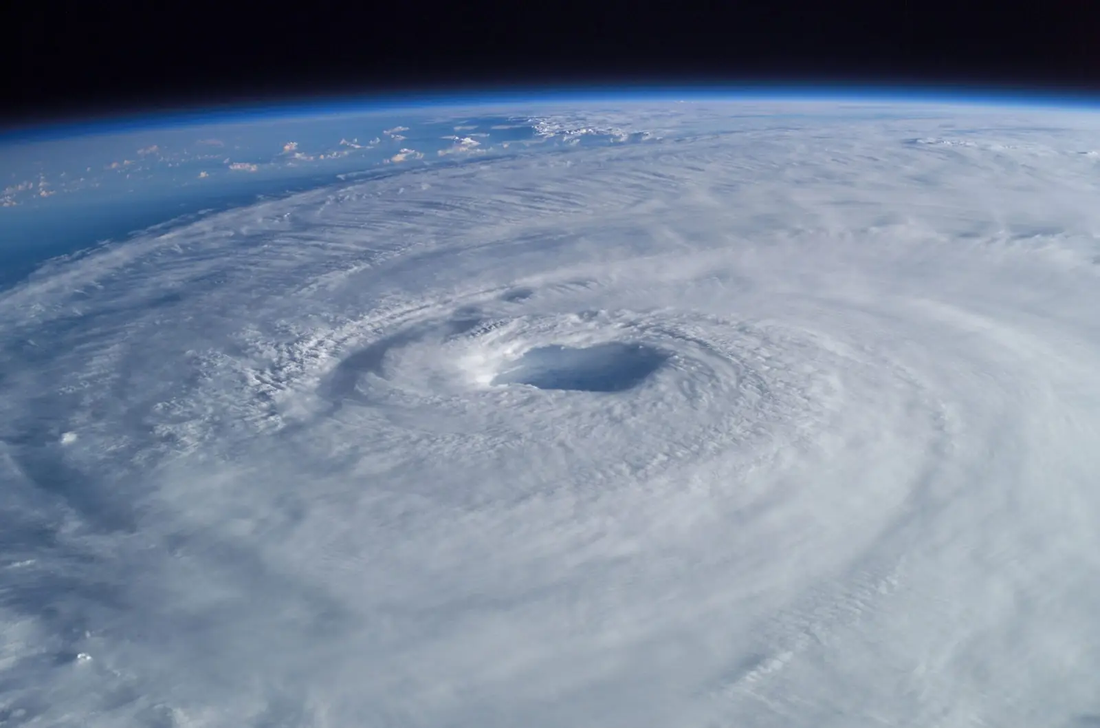
Illustrative NASA satellite image of a past Atlantic hurricane. Not the current Gulf system.
Cities under NHC warnings and watches
Per NHC Public Advisory 10, 11:00 PM ET Thu Oct 8 (no watch/warning changes; zones unchanged), with the NWS Mobile and Tallahassee zone alerts. Warnings and watches cover NWS forecast zones, not city limits — check weather.gov for your address. No watch or warning is posted right now for Leon County (Tallahassee).
Advisory 10: Isaias strengthens to 105 mph (Category 2)
Per NHC Public Advisory 10 (10 PM CDT), Hurricane Isaias was near 25.4N 88.4W, about 260 miles south of the mouth of the Mississippi River (about 295 miles NNE of Progreso, Mexico), with max winds 105 mph, moving NE at 14 mph, pressure 969 mb (Advisory 9 at 4 PM CDT had 100 mph and 975 mb; Intermediate Advisory 9A at 7 PM CDT still had 100 mph and 974 mb). Hurricane-force winds extend up to 25 miles from the center and tropical-storm-force winds up to 125 miles. No watch/warning changes: Hurricane Warning (Ocean Springs, MS to the Bay/Gulf County line, FL), Tropical Storm Warning (east of Bay/Gulf County line to the Aucilla River; and Jefferson/Plaquemines Parish line, LA to west of Ocean Springs), Storm Surge Warning (mouth of the Mississippi River to the Suwannee River), and Storm Surge Watch (Suwannee River to Yankeetown) are unchanged. NHC says Isaias could briefly become a major hurricane early Friday, then some weakening is forecast, but it should remain a dangerous hurricane approaching the northern Gulf Coast late Friday, with landfall within the warning area late Friday or early Saturday. Peak surge estimates are largely unchanged (5–7 ft Dauphin Island, AL to Indian Pass, FL; 4–6 ft Indian Pass to Steinhatchee River and Ocean Springs to Dauphin Island / Mobile Bay; 3–5 ft Steinhatchee to Suwannee and mouth of the Mississippi to Ocean Springs; 2–4 ft Suwannee to Yankeetown if peak surge is at high tide). Rainfall remains 4–8 inches (locally up to 15) across southern Alabama, the Florida Panhandle and Big Bend, and southwest Georgia Friday through the weekend. Tornado risk begins Friday evening in coastal Alabama, the Florida Panhandle, and far southwest Georgia, continuing Saturday. NHC says preparations in the warning area should be rushed to completion.
Advisory 9: Isaias strengthens to 100 mph (Category 2)
Per NHC Public Advisory 9 (4 PM CDT), Hurricane Hunters found Hurricane Isaias near 24.4N 89.3W, about 325 miles south of the mouth of the Mississippi River (about 215 miles north of Progreso, Mexico), with max winds 100 mph, moving NE at 12 mph, pressure 975 mb (Intermediate Advisory 8A had 85 mph). Hurricane-force winds extend up to 15 miles from the center and tropical-storm-force winds up to 125 miles. No watch/warning changes: Hurricane Warning (Ocean Springs, MS to the Bay/Gulf County line, FL), Tropical Storm Warning (east of Bay/Gulf County line to the Aucilla River; and Jefferson/Plaquemines Parish line, LA to west of Ocean Springs), Storm Surge Warning (mouth of the Mississippi River to the Suwannee River), and Storm Surge Watch (Suwannee River to Yankeetown) are unchanged. NHC expects additional strengthening through early Friday, a turn north on Friday, and landfall along the U.S. northern Gulf Coast within the warning area late Friday or early Saturday as a dangerous hurricane. Peak surge estimates are unchanged (5–7 ft Ocean Springs to Indian Pass and Mobile Bay; 4–6 ft Indian Pass to Steinhatchee; 3–5 ft Steinhatchee to Suwannee and mouth of the Mississippi to Ocean Springs; 2–4 ft Suwannee to Yankeetown if peak surge is at high tide). Rainfall is now forecast at 4–8 inches (locally up to 15) across southern Alabama, the Florida Panhandle and Big Bend, and southwest Georgia Friday through the weekend. Isolated tornadoes possible Friday night in coastal Alabama, the Florida Panhandle and far southwestern Georgia, continuing Saturday. NHC says preparations in the warning area should be rushed to completion today.
Advisory 8A: Isaias at 85 mph; Storm Surge Warning extended to Suwannee River
Per NHC Intermediate Advisory 8A (1 PM CDT), Hurricane Isaias was near 24.0N 89.8W, about 355 miles south of the mouth of the Mississippi River, with max winds 85 mph, moving ENE at 10 mph, pressure 975 mb. Hurricane-force winds extend up to 15 miles from the center and tropical-storm-force winds up to 90 miles. No watch/warning changes in 8A. Earlier today in full Advisory 8 (10 AM CDT), NHC extended the Storm Surge Warning from the Steinhatchee River eastward to the Suwannee River, FL; the Storm Surge Watch now runs from the Suwannee River to Yankeetown. Hurricane Warning (Ocean Springs, MS to the Bay/Gulf County line, FL) and Tropical Storm Warning (east of Bay/Gulf County line to the Aucilla River) are unchanged. NHC expects additional strengthening through early Friday, a turn northeast later today then north Friday, and landfall along the U.S. northern Gulf Coast within the warning area late Friday or early Saturday as a dangerous hurricane. Peak surge estimates include 5–7 ft Ocean Springs to Indian Pass (and Mobile Bay), 4–6 ft Indian Pass to Steinhatchee, 3–5 ft Steinhatchee to Suwannee, and 2–4 ft Suwannee to Yankeetown if peak surge is at high tide. Rain 3–7 inches (locally up to 15) from southeastern Louisiana to the Florida Big Bend Friday through the weekend. Isolated tornadoes possible Friday night in coastal Alabama, the Florida Panhandle and far southwestern Georgia, continuing Saturday into northern Florida. NHC says preparations in the warning area should be rushed to completion today.
Advisory 7: Isaias strengthens to 80 mph; watches and warnings unchanged
NOAA Hurricane Hunters located the eye of Hurricane Isaias near 23.3N 91.2W, about 420 miles SSW of the mouth of the Mississippi River. Max winds increased to 80 mph, moving ENE at 9 mph, pressure 979 mb (the 1 AM ET intermediate Advisory 6A had 75 mph and 981 mb). Hurricane-force winds extend up to 15 miles from the center and tropical-storm-force winds up to 90 miles. No changes to watches or warnings. NHC expects a turn northeast today and north on Friday, additional strengthening through early Friday, and landfall along the U.S. northern Gulf Coast within the warning area late Friday or early Saturday as a strong hurricane. NHC says preparations in the Gulf Coast warning area should be rushed to completion today. Peak surge estimates are unchanged (5 to 7 ft from Ocean Springs, MS to Indian Pass, FL, 4 to 6 ft from Indian Pass to the Steinhatchee River, 2 to 4 ft from the Steinhatchee River to Yankeetown, if peak surge occurs at high tide). NHC also notes isolated tornadoes are possible Friday night in coastal Alabama, the Florida Panhandle and far southwestern Georgia, continuing Saturday into northern Florida.
Dropsonde data from an Air Force Reserve Hurricane Hunter aircraft show Isaias has become a hurricane near 22.9N 91.9W, about 460 miles SSW of the mouth of the Mississippi River. Max winds 75 mph, moving ENE at 9 mph, pressure 982 mb.
Advisory 6: Hurricane Warning and Storm Surge Warning issued for part of the Florida Panhandle
NHC upgraded the Hurricane Watch to a Hurricane Warning from Ocean Springs, MS to the Bay/Gulf County line, FL, and upgraded the Storm Surge Watch to a Storm Surge Warning from the mouth of the Mississippi River to the Steinhatchee River, FL. A Tropical Storm Warning is now in effect east of the Bay/Gulf County line to the Aucilla River, FL (and from the Jefferson/Plaquemines Parish line, LA to west of Ocean Springs), and a Storm Surge Watch remains from the Steinhatchee River to Yankeetown, FL. Isaias was near 22.9N 91.9W, about 460 miles SSW of the mouth of the Mississippi River, with max winds near 70 mph, moving ENE at 9 mph, pressure 988 mb. NHC says Isaias is forecast to become a hurricane soon, continue strengthening through early Friday, and make landfall along the northern Gulf Coast within the warning area late Friday or early Saturday. Tropical storm conditions are expected to begin Friday, with hurricane conditions in the Hurricane Warning area Friday night into early Saturday. NHC now forecasts 3 to 7 inches of rain (locally up to 10) from far southeastern Louisiana to the Florida Panhandle Friday through the weekend.
Advisory 5A: Air Force Hurricane Hunters investigating Isaias
Tropical Storm Isaias near 22.8N 92.4W, about 480 miles SSW of the mouth of the Mississippi River. Max winds 65 mph, moving ENE at 8 mph, pressure 994 mb. Tropical-storm-force winds extend up to 60 miles from the center. No changes to watches: the Hurricane Watch (Bay St. Louis, MS to Indian Pass, FL), Tropical Storm Watches, and Storm Surge Watch (mouth of the Mississippi River to Yankeetown, FL) remain in effect. NHC says additional watches and warnings could be required for portions of the U.S. northern Gulf Coast tonight.
Advisory 5: Isaias quickly intensifying, forecast to be a hurricane by Thursday morning
Tropical Storm Isaias near 22.7N 92.9W, about 500 miles SSW of the mouth of the Mississippi River. Max winds increased to 65 mph, moving ENE at 8 mph, pressure 994 mb. Watches unchanged. On NHC's forecast track, Isaias passes north of the Yucatan Peninsula Thursday and makes landfall along the U.S. northern Gulf Coast late Friday or early Saturday, with further strengthening expected through Friday morning. Updated NHC peak surge estimates include 5 to 7 ft from Ocean Springs, MS to Indian Pass, FL and in Mobile Bay, 4 to 6 ft from Indian Pass to the Steinhatchee River, FL, and 2 to 4 ft from the Steinhatchee River to Yankeetown, FL, if peak surge occurs at high tide.
NOAA Hurricane Hunters located Tropical Storm Isaias near 22.6N 93.4W, about 520 miles SSW of the mouth of the Mississippi River. Max winds increased to 50 mph, moving ENE at 8 mph, pressure 997 mb. Tropical-storm-force winds extend up to 45 miles from the center. No changes to watches: the Hurricane Watch (Bay St. Louis, MS to Indian Pass, FL), Tropical Storm Watches, and Storm Surge Watch (mouth of the Mississippi River to Yankeetown, FL) remain in effect. NHC still forecasts Isaias to become a hurricane Thursday and approach the U.S. northern Gulf Coast Friday, and says additional watches and warnings could be required later today.
Advisory 4: Hurricane and Storm Surge Watches for the northern Gulf Coast
Tropical Storm Isaias near 22.4N 93.6W, about 540 miles SSW of the mouth of the Mississippi River. Max winds 45 mph, moving ENE at 8 mph, pressure 1000 mb. NHC issued a Hurricane Watch from Bay St. Louis, MS to Indian Pass, FL; a Tropical Storm Watch from the Jefferson/Plaquemines Parish line, LA to west of Bay St. Louis and from east of Indian Pass to the Aucilla River, FL; and a Storm Surge Watch from the mouth of the Mississippi River to Yankeetown, FL. NHC forecasts rapid strengthening, with Isaias expected to become a hurricane by Thursday and approach the U.S. northern Gulf Coast Friday. Tropical storm conditions could begin in the watch areas midday Friday and hurricane conditions late Friday. NHC peak surge estimates include 5 to 7 ft from Ocean Springs, MS to Indian Pass, FL, 3 to 5 ft from Indian Pass to the Aucilla River, and 2 to 4 ft from the Aucilla River to Yankeetown. 3 to 6 inches of rain (locally up to 10) is forecast from far southeastern Louisiana to the Florida Panhandle Friday through the weekend.
NHC upgraded Tropical Depression Nine to Tropical Storm Isaias near 22.0N 94.1W, about 580 miles SW of the mouth of the Mississippi River. Max winds 40 mph, moving ENE at 8 mph, pressure 1004 mb. NHC forecasts rapid strengthening, with Isaias expected to become a hurricane by Thursday, pass north of the Yucatan Peninsula Thursday and approach the U.S. northern Gulf Coast Friday. No coastal watches or warnings yet; NHC says Hurricane Watches will likely be required for a portion of the U.S. northern Gulf Coast later today. 3 to 6 inches of rain (locally up to 10) is forecast from far southeastern Louisiana to the Florida Panhandle Friday through the weekend.
Outlook: advisories continue on Tropical Depression Nine
NHC continues issuing advisories on Tropical Depression Nine in the southwestern Gulf. No other tropical cyclone formation is expected in the Atlantic basin during the next 7 days. The most recent advisory (Advisory 2) still shows no coastal watches or warnings.
Tropical Depression Nine near 22.1N 95.0W, about 605 miles SW of the mouth of the Mississippi River. Max winds 35 mph, moving east at 5 mph, pressure 1005 mb. NHC expects a tropical storm early Wednesday and a hurricane Thursday, passing north of the Yucatan Thursday and approaching the U.S. northern Gulf Coast Friday. No coastal watches or warnings. NHC says watches could be required Wednesday and residents from Louisiana to the Florida Panhandle should monitor updates; 3 to 6 inches of rain (locally up to 10) is possible from southeastern Louisiana to the Florida Panhandle Friday through the weekend.
NHC began advisories on Tropical Depression Nine (AL092026) near 22.1N 95.6W. Max winds 35 mph, moving east at 5 mph, pressure 1007 mb. Forecast to strengthen quickly. No coastal watches or warnings.
Invest 92L becoming better organized; advisories likely later in the day. NHC: interests from the Florida Panhandle to Louisiana should closely monitor. Formation chance near 100% in 48 hours and 7 days.
Signs of organization; a tropical depression anticipated within a day or so. Expected to turn north or northeast toward the northern Gulf Coast by the end of the week. Formation chance 90% in 48 hours and 7 days.
Trough of low pressure (AL92) producing disorganized showers and storms. A tropical depression expected to form mid-week. Formation chance 70% in 48 hours and 80% in 7 days. Northern Gulf Coast interests should monitor.
For official forecasts, watches and warnings, follow the National Hurricane Center and your local emergency officials. nhc.noaa.gov
Where things stand · NHC Advisory 6, Wed, Oct 7, 2026, 11:00 PM ET
Hurricane, Tropical Storm and Storm Surge Warnings are up for the northern Gulf Coast.
Now
Hurricane Isaias, 75 mph
Near 22.9N 91.9W in the southern Gulf, about 460 miles SSW of the mouth of the Mississippi River. Max winds near 75 mph, moving ENE at 9 mph, pressure 982 mb (NHC Tropical Cyclone Update, 11:30 PM ET Oct 7). In Advisory 6, NHC forecast Isaias to keep strengthening through early Friday.
Warnings
Florida Panhandle under warnings
Hurricane Warning: Ocean Springs, MS to the Bay/Gulf County line, FL. Tropical Storm Warning: east of the Bay/Gulf County line to the Aucilla River, FL (and the Jefferson/Plaquemines Parish line, LA to west of Ocean Springs). Storm Surge Warning: mouth of the Mississippi River to the Steinhatchee River, FL. Storm Surge Watch: Steinhatchee River to Yankeetown, FL. See cities under warnings and watches.
Timing and hazards
Friday into the weekend
NHC expects tropical storm conditions in the warning areas Friday and hurricane conditions in the Hurricane Warning area Friday night into early Saturday, with landfall within the warning area late Friday or early Saturday. Peak surge could reach 5 to 7 ft above ground from Ocean Springs, MS to Indian Pass, FL, 4 to 6 ft from Indian Pass to the Steinhatchee River, and 2 to 4 ft from the Steinhatchee River to Yankeetown if it arrives at high tide. NHC also forecasts 3 to 7 inches of rain, locally up to 10, from far southeastern Louisiana to the Florida Panhandle Friday through the weekend.
American Financial Claims is a public adjusting firm, not a weather service. For forecasts, watches, warnings, and evacuation orders, follow the NHC, the National Weather Service, and your local emergency officials.
Free policy coverage review
Send us your policy. We will tell you what it actually covers.
Most people find out what their policy says after the damage. A short review now shows where the gaps could be, while there may still be time to ask your agent about them.
Wind vs. floodHomeowners policies usually cover wind and exclude flood and storm surge. Flood is a separate policy. In coastal Texas, wind can be insured separately too (for example through TWIA).
Your hurricane deductibleFlorida hurricane deductibles are usually a percentage of the dwelling (Coverage A) limit, often 2%, 5% or 10%, not a flat dollar amount. It is subtracted from the claim payment; it is not a bill you pay the insurer. We show you the dollar figure. See an illustration or use the deductible calculator.
Dwelling limitIs Coverage A close to what it would cost to rebuild today, or was it set years ago?
Roof termsSome policies pay roofs on a depreciated (actual cash value) schedule. That can change a roof check a lot.
Contents & living expensesPersonal property limits and additional living expenses if you cannot stay in the home.
Exclusions & deadlinesWater backup, ordinance or law, screen enclosures, and the duties and notice deadlines after a loss.
Yes. NHC upgraded Tropical Depression Nine (formed from Invest 92L) to Tropical Storm Isaias in Advisory 3 at 5:00 AM ET, Wednesday, October 7, 2026, and Hurricane Hunter data showed Isaias became a hurricane with 75 mph winds in an NHC update at 11:30 PM ET that night. Check nhc.noaa.gov for the current status.
Where will it make landfall?
We do not know. As of Advisory 6, NHC forecasts landfall along the U.S. northern Gulf Coast within the warning area late Friday or early Saturday. A Hurricane Warning covers Ocean Springs, MS to the Bay/Gulf County line, FL, and a Tropical Storm Warning covers east of the Bay/Gulf County line to the Aucilla River. We do not forecast weather. Follow the NHC and your local emergency officials.
Does my homeowners policy cover flood?
Most homeowners policies exclude flood (rising water and storm surge). Flood is usually a separate policy through the National Flood Insurance Program or a private flood carrier. New NFIP policies generally have a 30-day waiting period, so a policy bought now may not cover this system. Wind and wind-driven rain are usually handled under the homeowners or windstorm policy.
What is a hurricane deductible, and how does it work?
Florida hurricane deductibles are usually a percentage of the dwelling (Coverage A) limit, often 2%, 5% or 10%, not a flat dollar amount. The deductible is subtracted from the claim payment. It is not a bill you pay the insurer. Many hurricane losses, such as roof, interior water and contents damage, end up well above the deductible, so it is worth having the damage properly documented and reviewed before assuming a claim is not worth filing. Illustration only: a $400,000 dwelling limit with a 2% hurricane deductible is $8,000; a $60,000 covered loss would pay about $52,000 before any other policy limits. Every policy and loss is different, and which deductible applies depends on your policy wording and how the storm is classified. Try the hurricane deductible calculator, or get a free policy review from American Financial Claims to see your own numbers.
Does the policy review cost anything?
No. The review is free and it does not hire us. If you later have a claim and decide to hire American Financial Claims, the fee is a percentage of the recovery, disclosed in a written contract before you sign. No recovery, no fee.
Can you change or add coverage for me?
No. American Financial Claims is a public adjusting firm. We do not sell insurance or change policies. If the review turns up a gap, talk to your agent or carrier. Carriers often stop accepting new policies or changes once a storm threatens an area, so do it early.
Where are you licensed?
Armando Ferrer is individually licensed as a public adjuster in 15 states. The Florida firm license is G288962. We confirm which license applies to your property before we are hired. We do not claim the firm holds a license in every state.
How to say it: Isaias is pronounced ees-ah-EE-ahs.
Important information
This page is general educational information. It is not legal advice, not a weather forecast, and not a coverage determination. Storm information reflects public National Hurricane Center outlooks and advisories as of Wednesday, October 7, 2026, 11:00 PM ET (Advisory 6), and may be out of date. Always check nhc.noaa.gov and your local officials.
American Financial Claims is a public adjusting firm (Florida firm license G288962). Our individual public adjusters are licensed in 15 states; we confirm the license that applies to your property before we are hired. We do not sell insurance, change policies, or provide legal services. A free review does not create a contract. If you hire us, the fee is a percentage of the recovery, disclosed in a written contract before you sign. No recovery, no fee. Results depend on the policy, the facts, and the carrier, and are not guaranteed.
This is an advertisement for public adjusting services. If you have had a claim for an insured property loss or damage and you are satisfied with the payment by your insurer, you may disregard this advertisement.
No recovery. No fee.
Start with the file you already have.
Tell us the property, the carrier, and where the claim stands. A person from American Financial Claims calls you back.
This form does not hire us. Individual public adjusters are licensed in 15 states.